Bathymetric Survey

Accurate bathymetry is essential for navigation and ocean science.
Having accurate information about the depth of the water and potential underwater hazards is essential for safe maritime transportation, especially for large ships. Scientists also use bathymetric data to study the effects of climate change and to monitor beach erosion, sea-level rise, and subsidence. Bathymetric maps also help to determine where fish and other marine life feed, live and breed.

With GeoMax you can email a full drawing in DWG/DXF format in under one-minute. This ensures our clients can carry out their work, based on your survey results, in a far shorter period than has been possible in the past.

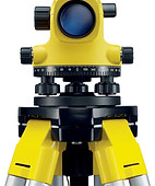
Survey Max is an authorised GeoMax dealer and can help you identify the ideal equipment for your project

Explore our products

Survey Max is a fully authorised distributor for Geomax International, part of the Hexagon group of companies.