Ensure ultimate reliability with GeoMax GNSS systems.

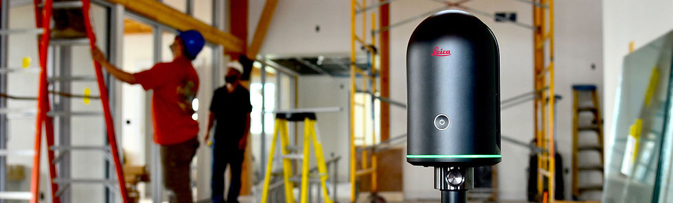
Leica BLK360 Laser Scanner


The Leica BLK360 captures the world around you with full-colour panoramic images overlaid on a high-accuracy point cloud. Simple to use with the single push of one button, the BLK360 is the smallest and lightest imaging laser scanner of its kind. Anyone who can operate an iPad can now capture the world around them with high-resolution 3D panoramic images.
Using Leica Cyclone FIELD 360 or the Autodesk ReCap Pro mobile-device app, the BLK360 streams image and point cloud data to an iPad or final project data to Cyclone REGISTER 360 and X-Pad Fusion via Wi-Fi. With automated workflows in both software offerings, the BLK360 plus the software solution of your choice, dramatically streamlines the reality capture process thereby opening this technology to non-surveying individuals. Simple export of LGS or RCP files makes working with point cloud data downstream in the Leica Geosystems and Autodesk suites simple and efficient, allowing users to spend less time processing data and more time creating meaningful deliverables.
BLK360 imaging laser scanner
-
Allows you to scan in high, standard and fast resolutions
-
Weighs 1 kg / Size 165 mm tall x 100 mm diameter
-
Less than 3 minutes for full-dome scan (in standard resolution) and 150 MP spherical image generation
-
360,000 laser scan setpoints per second
-
High-Dynamic Range (HDR) and thermal imaging